

Roughly about the middle of each and every month NOAA publish a Global Climate Report. The June 2019 version has now been published. Once we reach the end of the month it takes until about now to receive all the global data, carefully check it all, then write up the assessment with precise details.
June 2019 has already been reported via other sources to have been the hottest June ever recorded since records began, (see here and also here), hence it it worth stopping by this update and taking a look.
June 2019 Climate: Temperature
The full NOAAS Global Climate Report not only covers Temperature, but also other aspects. However, the story of the moment is Temperature, so let’s specifically focus down on that.
Record Breaking Global Climate
Averaged as a whole, the June 2019 global land and ocean temperature departure from average was the highest for June since global records began in 1880 at +0.95°C (+1.71°F).
- This value bested the previous record set in 2016 by 0.02°C (0.04°F).
- Nine of the 10 warmest Junes have occurred since 2010. June 1998 is the only value from the previous century among the 10 warmest Junes on record, and it is currently ranked as the eighth warmest June on record.
- Junes 2015, 2016, and 2019 are the only Junes that have a global land and ocean temperature departure from average above +0.90°C (+1.62°F).
- June 2019 also marks the 43rd consecutive June and the 414th consecutive month with temperatures, at least nominally, above the 20th century average.
Overall, here is what has been happening to June on a Global Scale since records began …

The June 2019 European Heat Wave
- Europe had its warmest June on record at 2.93°C (5.27°F) above the 1910–2000 average.
- During the last week of June, an intense heat wave affected much of Europe, bringing temperatures that were 6.0°–10.0°C (10.8°–18.0°F) above average and resulting in numerous new records set.
- According to Spain’s State Meteorological Agency, 29 stations registered new June maximum temperatures, with five of those stations setting a new all-time temperature record.
- During the 25–30 June heat wave, France set a new national high maximum temperature when temperatures soared to 45.9°C (114.6°F) at Gallargues-le-Montueux in Gard.
- Germany had its warmest June on record with a temperature departure from average of +4.4°C (+7.9°F).
- The Czech Republic also set a new national maximum temperature for June. The temperature of 38.9°C (102.0°F) was set on 26 June 2019 in Doksany.
- Hungary had its warmest June on record.
- De Bilt, Netherlands had its highest June temperature since records began in 1901
- Austria had its warmest June since national records began in 1767
But what about El Niño?
El Niño – Southern Oscillation (ENSO) phenomenon, does have a measurable influence on the global climate temperatures. They have a graphic (see below) that depicts the monthly global temperature anomalies—that is, each month compared its 20th century average—since 1980 and it shows you this influence.
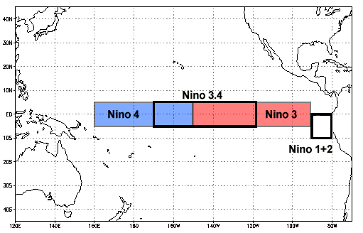
The height of the bar represents the global temperature anomaly for the month. The color of the bar represents the ENSO status, as defined by the Oceanic Niño Index (ONI), which is the three-month average temperature anomaly in the Niño3.4 region centered on that month.
- Months colored in red had ONI values indicating an El Niño episode active (at least five consecutive months with the three-month Niño3.4 temperature more than 0.5°C (0.9°F) above the working “normal”).
- Blue represents La Niña episodes, more than 0.5°C (0.9°F) cooler than normal.
- Months in grey indicate ENSO-neutral conditions, when neither El Niño nor La Niña were present.

There are a few things that are immediately obvious …
- Nearly every month since 1980 has been above the 20th century average, and has generally warmed through the period.
- El Niño-like conditions (those months in red) tend to be warmer than neighboring periods, and La Niña-like conditions (blue) tend to be cooler.
- Protracted El Niño-like episodes tend to warm through the event, while La Niña-like episodes tend to cool through the event.
- There are exceptions to all of the above points.
Will 2019 be the warmest year ever?
NOAA, as do others, do have a view on that. What they have is a little bit more than just a guess. They utilize simulations of possible outcomes based on how widely the global temperature time series has varied from month to month in the historical record. Once they have created plausible scenarios, they then identify the 95% range of most likely outcomes.
Based on current anomalies and historical global annual temperature readings, it appears that it is virtually certain that 2019 will be a top 10 year, consistent with a strong propensity since 1988 for recent years to be initially ranked as a top 10 year. Our calculations suggest:
-
- 100.0% chance of a top 5 year
- 100.0% chance of a top 10 year
- 95% confidence interval of 2nd to 4th warmest year on record